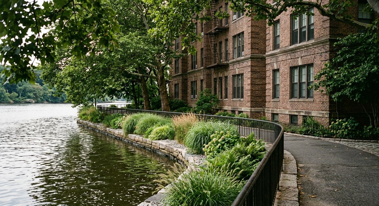
If you picture Bronx waterfront living as one long stretch of shoreline, you may miss what actually makes this part of the city so interesting. The Bronx offers several different outdoor settings, and each one shapes daily life in its own way. If you are trying to decide where your lifestyle fits best, this guide will help you compare the Bronx’s water and park corridors with more clarity. Let’s dive in.
Why Bronx outdoor living varies
The Bronx is not one single waterfront market. According to NYC DOT greenway planning and the Bronx River Alliance, the borough’s outdoor geography works more like a set of separate shoreline and river corridors.
That matters when you start looking at homes. One area may feel beach-oriented, another may center on trails and boating, and another may combine major parkland with river views. If you understand those differences early, you can narrow your search faster.
The main Bronx outdoor corridors
Northeast shoreline living
The northeast shoreline includes Pelham Bay Park, Orchard Beach, City Island, and Throgs Neck. This part of the Bronx connects outdoor living to bay access, shoreline views, and a more edge-of-the-city feel.
For many buyers, this is the clearest version of water-first living in the Bronx. You are often comparing low-rise residential blocks and direct access to large open spaces rather than a dense, continuous urban waterfront.
Bronx River corridor living
The Bronx River corridor runs through places tied to the Bronx River Greenway, including Soundview, Concrete Plant Park, Starlight Park, and the South Bronx waterfront. The Bronx River Alliance describes this as an 8-mile greenway that parallels the river from the Westchester border to Soundview Park.
This corridor tends to appeal to people who want active outdoor access. Biking, boating, fishing, and nature-oriented recreation play a bigger role here than a classic beach setting.
Harlem River corridor living
The Harlem River edge includes Riverdale, Kingsbridge, Highbridge, Mott Haven, and Port Morris, based on NYC DOT planning materials. The Harlem River Greenway is being built out in phases as a planned seven-mile corridor between Van Cortlandt Park and Randall’s Island.
This area tells a different Bronx waterfront story. In some sections, you get established residential areas near the river, and in others you see more mixed-use waterfront development and public open space taking shape.
Northwest parkside living
The northwest Bronx stands out for Van Cortlandt Park and Wave Hill. Here, outdoor living is shaped less by a beach or esplanade and more by major parkland, trails, wetlands, and elevated river views.
If your ideal setting is park-first rather than water-first, this part of the borough can feel very different from the shoreline areas. The draw is often the scale of green space and the day-to-day access to trails, gardens, and preserved natural areas.
What daily life can look like
Pelham Bay Park and Orchard Beach
Pelham Bay Park is the largest park in New York City. It brings together shoreline, bridle paths, hiking trails, golf, and Orchard Beach, which is the Bronx’s only public beach.
Orchard Beach reopened in May 2026 after a $114 million reconstruction. The beach spans 115 acres along 1.1 miles of shoreline, which makes this corridor one of the most distinct outdoor destinations in the borough.
If you are drawn to beach access and broad open waterfront areas, this section of the Bronx offers a lifestyle that is hard to confuse with the rest of the city. It is one of the clearest examples of a true shoreline-oriented routine.
Van Cortlandt Park and Wave Hill
Van Cortlandt Park offers a different kind of outdoor anchor. Official park materials describe a 573-acre preserve with freshwater wetlands, a lake area, hiking trails, and the Putnam Trail.
That gives the northwest Bronx a strong trail-oriented identity. Instead of focusing on a shoreline lifestyle, you may be thinking more about long walks, preserved natural areas, and a large park landscape close to home.
Wave Hill adds another layer to that experience. It is a 28-acre public garden and cultural center in Riverdale overlooking the Hudson River and the Palisades, with sweeping views that create a more scenic, garden-centered version of parkside living.
Bronx River access and recreation
Along the Bronx River, the outdoor mix becomes more active and water-based. The corridor is known for biking, boating, fishing, and nature access, especially around Soundview Park, Concrete Plant Park, and Starlight Park.
Concrete Plant Park includes the Bronx River Foodway, which NYC Parks describes as the first edible food forest in a public park. Starlight Park includes ADA-accessible launch and landing points on the water trail, while Soundview Park offers fields, a running track, walking and biking paths, picnic space, and wide water views.
If you like the idea of a greenway lifestyle, this corridor may stand out more than the beachfront areas. The emphasis is often on movement, access, and connection to the river rather than on one big destination beach.
How housing patterns change by area
The Bronx’s home types near waterfronts and parks are shaped heavily by zoning and block structure. That is one reason outdoor-oriented areas can feel so different from one another.
In lower-density sections, especially around places like City Island, Throgs Neck, and some Riverdale or Fieldston blocks, the housing pattern often leans toward low-rise detached or semi-detached one- or two-family homes. That pattern lines up with city zoning and rezoning materials for those areas.
City Island rezoning documents note that most of the island was zoned R3-2 and that most existing homes there are detached houses. In Throgs Neck, city zoning materials describe R4 districts that allow attached townhouses, multi-family apartment buildings, and detached or semi-detached homes, along with C3A districts that permit single- and two-family detached residences.
For you as a buyer, that often means the outer-edge waterfront areas can offer a lower-rise streetscape and a housing rhythm that feels different from interior Bronx corridors. It is not a boroughwide rule, but it is a useful pattern when comparing options.
Where newer waterfront development fits
Not every Bronx waterfront area follows the older low-rise pattern. Some parts of the borough’s waterfront are increasingly mixed-use, with larger residential projects and public open space playing a bigger role.
Official city and borough announcements describe Bronx Point as a mixed-use project with up to 1,000 homes and a waterfront esplanade. Fordham Landing South is described as a Harlem River development proposed for 927 residential units.
These projects point to a more urban waterfront model in certain locations. If you want newer development near public waterfront space, you may be looking at a very different housing environment than what you would find in places like City Island or some lower-density parkside blocks.
Comparing park-first and water-first living
When people start exploring the Bronx, they often ask which neighborhood is best for outdoor living. A better question is what kind of outdoor living fits your routine.
Here is a simple way to think about it:
- Water-first: Look toward the east and northeast shoreline if beach access, bay settings, and shoreline views are the main draw.
- Trail-and-river-first: Look along the Bronx River corridor if you want greenway access, paddling, biking, and nature-based recreation.
- Park-first: Look toward the northwest Bronx if large parkland, trails, gardens, and river overlooks matter more than direct shoreline living.
- Mixed-use waterfront: Look along parts of the Harlem River if you want a more urban blend of residential development and public open space.
This framework can make your home search much more practical. Instead of trying to compare the whole Bronx at once, you can focus on the outdoor setting that matches how you want to spend your time.
What to watch for as you search
Outdoor access can mean very different things from one Bronx area to another. In one place, it may mean being near a beach or bay. In another, it may mean trailheads, wetlands, gardens, or river launches.
As you tour homes, pay attention to the immediate surroundings as much as the property itself. The biggest lifestyle difference is often not just the home type, but the scale of nearby open space, the kind of recreation available, and whether the area feels more residential, more park-centered, or more mixed-use.
That is especially true in the Bronx, where the waterfront story is not one-size-fits-all. The borough offers several distinct versions of outdoor living, and each one creates a different experience of home.
If you want help comparing Bronx waterfront and parkside options in a simple, practical way, connect with Maria Porco-Rosa. You can get a clearer view of which setting fits your goals before you start narrowing down homes.
FAQs
What does waterfront living in the Bronx usually mean?
- In the Bronx, waterfront living usually means one of several distinct settings, including the northeast shoreline, the Bronx River corridor, or parts of the Harlem River edge, rather than one continuous waterfront district.
What is the biggest park for parkside living in the Bronx?
- Pelham Bay Park is the largest park in New York City, and Van Cortlandt Park is another major Bronx outdoor anchor with preserve land, wetlands, trails, and a lake area.
What is the Bronx River Greenway like for outdoor recreation?
- The Bronx River Greenway is an 8-mile corridor linked to biking, boating, fishing, and nature access, with key destinations including Soundview Park, Concrete Plant Park, and Starlight Park.
What kinds of homes are common near Bronx waterfront areas?
- In lower-density waterfront and parkside sections such as City Island, Throgs Neck, and some Riverdale or Fieldston blocks, you will often see low-rise detached or semi-detached one- or two-family homes, while some newer waterfront areas include larger mixed-use residential projects.
How is Harlem River living different from other Bronx waterfront areas?
- Harlem River areas can include a more urban mix of residential development and public open space, which differs from the beach-focused northeast shoreline and the trail-oriented Bronx River corridor.