Thinking about the Bronx but not sure where to start? With more than a million residents and dozens of distinct neighborhoods, it can feel overwhelming to pin down the right fit. You want a clear picture of daily life, commute options, and the tradeoffs between quiet blocks and lively corridors. This guide breaks down Bronx neighborhoods by lifestyle so you can quickly shortlist areas, plan visits, and move forward with confidence. Let’s dive in.
Bronx at a glance
The Bronx is New York City’s northernmost borough with a 2020 Census population of about 1.47 million. You will find dense, transit-first corridors as well as pockets that feel suburban. The borough also holds major city assets like Pelham Bay Park, the Bronx Zoo, and the New York Botanical Garden.
Commutes and convenience vary by block. West and South Bronx neighborhoods offer more subway lines and shorter trips to Manhattan, while parts of the East Bronx lean more car friendly. To compare neighborhood profiles and boundaries, start with the NYC Department of City Planning neighborhood profiles.
Parks and culture are a big draw. Pelham Bay Park is the largest park in New York City, and Bronx Park is home to the New York Botanical Garden and the Bronx Zoo. You will also find riverfront views in places like Riverdale and growing waterfront access in Mott Haven.
Find your fit by lifestyle
Every Bronx neighborhood has its own rhythm. Many blocks shift quickly from a busy avenue to a quiet side street, so use these clusters as a starting point, then plan on-the-ground visits.
Quiet suburban-feel
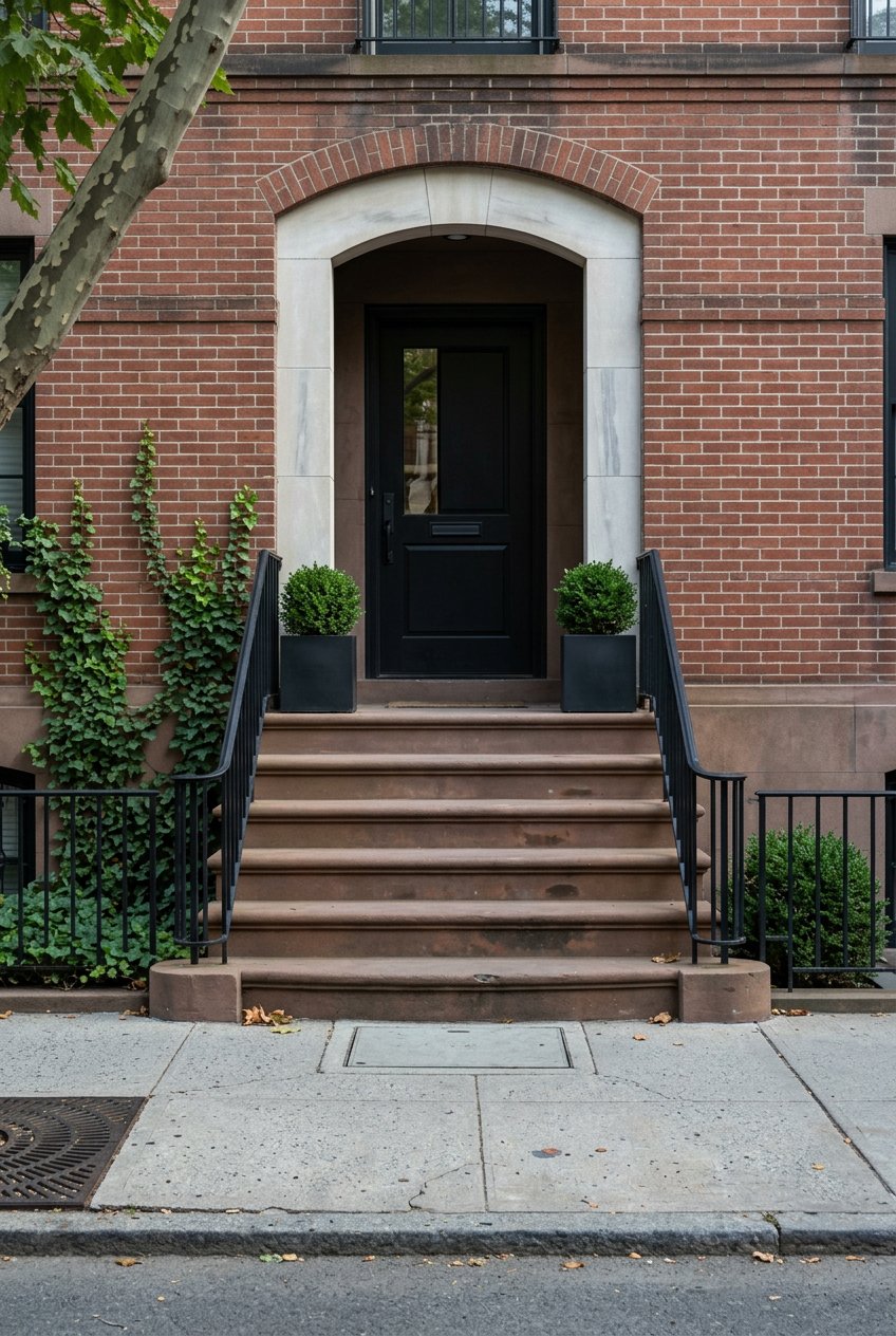
If you want tree-lined streets and more space, look at Riverdale, Fieldston, Country Club, Throggs Neck, and City Island. Housing ranges from single-family homes and pre-war co-ops to small apartment buildings. Riverdale offers Metro-North service to Grand Central, while City Island and Throggs Neck are more car dependent.
- Vibe: Leafy, residential, local diners and waterfront spots on City Island.
- Transit: Metro-North in Riverdale; limited subway access in some pockets; driving common.
- Who it fits: You value quieter streets, larger homes, and do not mind relying on commuter rail or a car.
Family-focused near parks
Pelham Bay, Morris Park, Van Nest, and Castle Hill balance neighborhood feel with city conveniences. You will see two- and three-family homes, co-ops, and mid-rise apartments. Proximity to Pelham Bay Park is a major bonus for outdoor time.
- Vibe: Community services, local schools, easy access to green space.
- Transit: Subways and buses vary by block; driving and parking can be easier than in denser areas.
- Who it fits: You want calmer blocks with parks close by while keeping practical city amenities.
Transit-rich and urban
Fordham, Kingsbridge, Belmont, and Tremont center around busy commercial corridors. Housing is mainly pre-war apartment buildings and multifamily homes. You get multiple transit lines, plus shopping and dining hubs like Arthur Avenue.
- Vibe: Active streets, ethnic restaurants, strong retail presence.
- Transit: Multiple subway lines and buses; Metro-North is nearby at Fordham for trips to Grand Central.
- Who it fits: You prioritize transit, neighborhood life, and easy errands over quiet.
New development and nightlife emerging
Mott Haven, Port Morris, and the Concourse area have seen notable change. Expect newer rentals and condos, converted lofts, and some older brownstones. You will find growing dining, gallery spaces, and waterfront promenades.
- Vibe: Evolving blocks, construction activity, new cafes and restaurants.
- Transit: Strong subway access to Manhattan; car optional depending on your routine.
- Who it fits: You want newer housing options and a quick commute with an energy-filled streetscape.
Industrial and mixed-use edges
Hunts Point and parts of Port Morris anchor the borough’s working waterfront. Residential pockets exist near core industrial zones, but you will see trucks and hear activity from distribution centers.
- Vibe: Industrial during the day, active community organizations.
- Transit: Local buses and subways serve surrounding blocks; exact access depends on the street.
- Who it fits: You work in nearby industries or want lower rents while accepting industrial adjacencies.
Waterfront and maritime
City Island, Throggs Neck, Soundview, and sections of the South Bronx waterfront offer access to the water and marinas. Housing is a mix of single-family homes, mid-rise buildings, and waterfront condos where available.
- Vibe: Maritime culture on City Island, waterfront parks and esplanades in select areas.
- Transit: Varies widely; many households drive, though some areas have useful transit.
- Key note: Check flood maps and insurance needs using the NYC Flood Hazard Mapper before you buy near the water.
Daily life details that matter
Housing types and ownership
You will find two- and three-family houses, walk-ups, mid-rise apartments, NYCHA developments, and pre-war co-ops. Newer condos and rentals are concentrated in parts of the South Bronx and Mott Haven. Co-ops are common in areas like Riverdale and Morris Park, so budget for maintenance fees and review building rules early. Two- and three-family homes can offer owner-occupied rental income, subject to financing and local regulations.
Commuting and transit
Transit-first neighborhoods include Mott Haven, Concourse, Fordham, Kingsbridge, and Belmont. Many residents rely on the subway and buses for daily commutes. Plan routes with the MTA subway map and consider the Metro-North schedules if you live near Riverdale or Fordham and work near Grand Central. Driving is common in parts of the East Bronx, but major expressways can be congested at peak hours. Parking rules and availability vary by block.
Schools and family services
Public school options vary by zone and program. To get accurate zone details and performance data, use official NYC Department of Education tools and school report cards. Private and parochial schools have a strong presence in some neighborhoods. Large parks, the Bronx Zoo, and community centers add family programming across the borough.
Safety, perception, and community
Crime rates have declined significantly since the 1990s, but conditions can vary on a block-by-block level. Review up-to-date statistics through NYPD CompStat and visit at different times of day to see how a street feels in practice. Local community boards, block associations, and faith organizations often shape the neighborhood experience.
Parks, culture, and dining
Pelham Bay Park and Van Cortlandt Park anchor outdoor life. Bronx Park hosts year-round programming at the New York Botanical Garden and the Bronx Zoo. Arthur Avenue in Belmont is known for Italian food, and Mott Haven and Port Morris have growing dining and arts scenes. Riverdale’s Wave Hill and the Bronx Museum add culture and events.
Health, environment, and resilience
Some industrial districts face higher exposure to emissions, and parts of the Bronx have documented respiratory health burdens. For neighborhood-level information, review the NYC Department of Health community health profiles. If you are considering waterfront or low-lying areas like Soundview or sections of the South Bronx, evaluate flood risk and insurance needs with the NYC Flood Hazard Mapper.
Everyday logistics
Fordham Road and Belmont offer dense retail and grocery options, while some South Bronx pockets are targeted for improved food access. Major medical centers include Montefiore Medical Center and BronxCare. Library branches, post offices, and other civic services are spread across the borough.
How to scout neighborhoods
Use this checklist to make confident comparisons:
- Test your commute door to door during peak hours. Try your top two routes.
- Walk the main corridors and side streets at morning, midday, evening, and weekend times.
- Note nearby parks, grocery stores, pharmacies, and daycare or after-school options.
- Ask about parking rules, alternate side schedules, and garage or lot availability.
- Review school zones and request official info and visit days from the Department of Education.
- Check NYPD CompStat for crime trends and talk with local community boards when possible.
- Review flood maps and ask about flood insurance if you are near the water.
- Listen for noise from highways, truck routes, or nightlife to gauge your tolerance.
Next steps
If you are early in your Bronx search, start with 2 to 3 lifestyle clusters that match your priorities, then schedule on-the-ground visits. Keep notes by block, not just by neighborhood name. When you are ready to refine options, reach out for local guidance, co-op insights, and a practical plan to compare homes and buildings.
Ready to move from research to results? Connect with Maria Porco-Rosa for a friendly conversation about your goals and a clear next step.
FAQs
What makes the Bronx different from other boroughs?
- The Bronx blends dense urban corridors with quieter, suburban-feel pockets, and it hosts major parks and cultural institutions like Pelham Bay Park, the Bronx Zoo, and the New York Botanical Garden.
Which Bronx areas offer shorter Manhattan commutes?
- West and South Bronx neighborhoods such as Mott Haven, Concourse, Fordham, Kingsbridge, and Belmont have multiple subway lines, and Metro-North from Riverdale or Fordham can be fast for jobs near Grand Central.
How do I evaluate school options in the Bronx?
- Use official NYC Department of Education tools for zoning and report cards, request visit days, and speak with schools directly to understand programs and admissions.
Are Bronx neighborhoods safe?
- Safety varies by block and time of day. Review precinct-level trends with NYPD CompStat and visit in person at different times to gauge street activity and your comfort.
What should waterfront buyers consider in the Bronx?
- Check FEMA and the NYC Flood Hazard Mapper for flood zones, review insurance requirements, and visit during high tide or stormy weather to see drainage and access.
Where can I find official neighborhood and transit information?
- Start with the NYC Department of City Planning neighborhood profiles, the MTA subway map, and Metro-North schedules; then verify details during in-person visits.